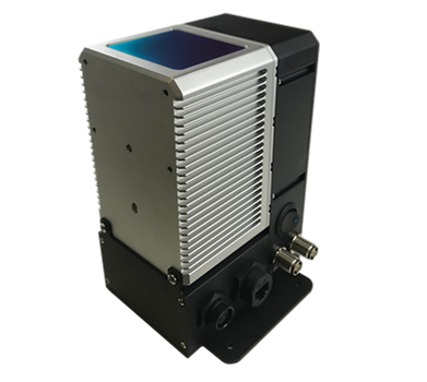
RTK GNSS/INS
POLYNAV 2000H/P/E
ALL PRODUCTS
MEMS RTK GNSS/INS


POLYNAV 2000H/P
-
High accuracy position, velocity, acceleration, attitude, heading, angular rate and heave
-
GPS, GLONASS, Beidou, Galileo and SBAS
-
Dual frequency (L1 & L2) RTK
-
Dual antenna for accurate heading
-
Best in class price-performance ratio
-
100 Hz navigation solution and the raw measurement output
-
Accurate attitude/heading whether the platform is static or moving
-
Tactical grade IMU sensors
-
Multiple sensor fusion
-
ROS driver ready
-
Heave message
"ULTRA" GNSS/INS
POLYNAV 2000S
-
Centimeter level positioning with precise attitude and heading whether the platform is static or moving
-
Precision velocity, acceleration, attitude (Roll, pitch, heading), and angular rate
-
GPS, GLONASS, Beidou, Galileo*, and SBAS, QZSS; 240 Tracking Channels
-
Dual frequency (L1 & L2) RTK
-
Global PPP
-
Dual antenna for accurate heading
-
Best in class price-performance ratio
-
100 Hz navigation solution and the raw measurement output
-
Tactical grade, near FOG performing solid-state IMU sensor
-
Multiple sensor fusion
-
ROS driver ready
-
Heave message
-
IP67 environmental rating
* Upon request


FOG INERTIAL NAVIGATION SYSTEM
POLYNAV 2000F
-
High accuracy position, velocity, acceleration, attitude, heading, angular rate and heave
-
GPS, GLONASS, Beidou, Galileo and SBAS
-
Dual frequency (L1 & L2) RTK
-
Dual Antenna for accurate heading
-
Best in class price-performance ratio
-
100 Hz navigation solution and the raw measurement output
-
Accurate attitude/heading whether the platform is static or moving
-
Fiber Optic Gyroscope (FOG)
-
Multiple sensor fusion
-
ROS driver ready
-
Heave message

-Recovered.png)
AERIAL HD MAPPING SYSTEM
POLYSCANNER
-
Dual frequency RTK with a centimeter-level accuracy
-
High level of integration and compact
-
Robust design
-
The long range Lidar and Global Shutter sensors
-
Superior performance in comparison with mechanical Lidars
-
Post fusion of all on-board sensor data
-
Point cloud post-processing software available


RTK GNSS/INS
POLYNAV 2000P OEM
-
High accuracy position, velocity, acceleration, attitude (Roll, pitch, heading), angular rate
-
GPS, GLONASS, Beidou, Galileo and SBAS
-
Dual frequency (L1 & L2) RTK
-
Dual antenna for accurate heading
-
Best in class in size and price-performance ratio
-
100 Hz navigation solution and the raw measurement output
-
Accurate attitude/heading whether the platform is static or moving
-
Tactical grade IMU sensors
-
Multiple sensor fusion
-
ROS driver ready
MOBILE SENSOR FUSION SOLUTIONS
POLYMAPPER
-
Out of the box solution for Robotics, HD Mapping, and Autonomous Vehicles
-
Easy to install, quick start-up
-
Improved performance under the bridges and urban canyons
-
Maintains accurate attitude moving or static
-
Available as a standard, semi-custom, as well as OEM solution
-
The total cost of ownership lower than all components separately
-
Post-processing Sensor Fusion software


LARGE SCALE MOBILE HD MAPPING SOLUTION
MOBILE MAPPING SOLUTIONS
-
High speed, high accuracy and high density
-
Great accuracy in GNSS denied environments such as garages, bridges and urban canyons
-
A complete solution for sensor data collection
-
Precision GNSS/INS with the centimeter-level accuracy
-
Post processing software for data fusion
